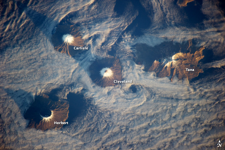
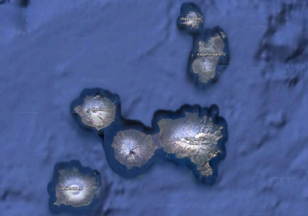
Today’s plan is an “unplanned” landing at Chuginadak Island, part of the strangely named Islands of Four Mountains archipelago. It is meant to be a sea day en route to Unalaska Island, but our captain is curious about what looks like a sandy land bridge between Mount Cleveland, an active volcano, and Tana island that has been spotted on Google Earth. The image below is from the ISS Expedition 38 crew image of the Islands of the Four Mountains with cloud obscuring the potential land bridge between Cleveland and Tana islands.
At 7am, Captain Le Rouzic wakes the passengers for the passing of Chagulak Island, an uninhabited island teeming with thousands of fulmars, Laysan albatross, and black-footed albatross. 2 male orcas are spotted, which I track from the stern of the ship. One heads towards Chagulak Island and disappears, the other in the opposite direction. Then 3 orcas surface closer to the stern of the ship, which turns out to be one male, one female, and one calf. They surface once and disappear.


Le Soleal drops off a couple of expedition team members in zodiacs in Applegate Cove to do a reconnaissance of the area seen in the Google Earth photos. It turns out to indeed be a sandy area that will offer a 2-hour return hike, starting from the landing site on the Bering Sea, hiking out over black volcanic sands for 3-4 km to a viewpoint over the North Pacific Ocean. There’s a headwind on the hike to the viewpoint, which takes about 50 minutes without dawdling. Just before the viewpoint, Arctic fox tracks can be seen.


It’s a landscape of contrasts. On one side, Mount Cleveland towers above everything, with a puff of steam escaping from the caldera. On the other side, black sand-dunes and green beach ryegrass make a stunning contrast, with the Tana volcano obscured by the cloud.


The hike back is easier without the headwind and takes about 45 minutes. One the way back, I pass two Captains, Le Rouzic and our Alaskan pilot, “Captain Jay”, who can’t resist the lure of hiking from the Bering Sea to the North Pacific Ocean. They’re cutting a brisk pace in order to make it to the viewpoint and back again by the last zodiac. Then again, two captains should be able to summon one whenever they’re ready. No one is leaving without them.
There’s enough time before the last zodiac back to the ship to pick up some plastic. A cargo ship carrying logs has lost its load somewhere at some point, and the logs and various plastic flotsam have been tossed up on the beach by the Bering Sea. Ropes, plastic buckets, a stray orange buoy, plastic bottle tops, small pieces of blue shattered plastic – all needs to be collected and taken back to the ship for recycling.
We need to be in Dutch Harbour first thing tomorrow morning for US Immigration and Customs clearance, so Le Soleal is underway again just after 6 pm, with some amazing views of the Carlisle Volcano again. We pass through the easternmost islands of the Islands of the Four Mountains with the sunken calderas.
A few hours later see the towering Mount Vsevidof with its snowy slopes, low grey cloud, and chain of smaller volcanic vents as the light fades.


